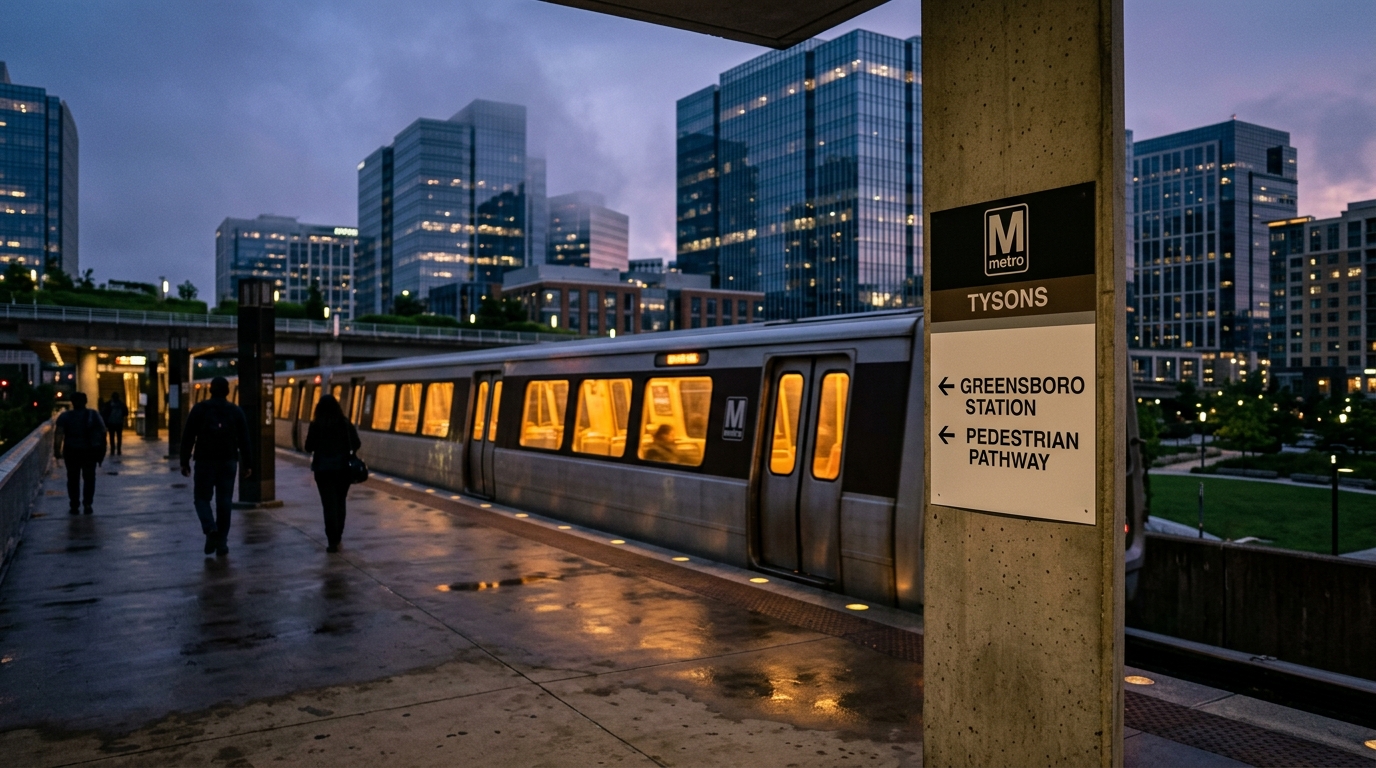
Navigating the bustling streets of Tysons can often feel like a high-stakes game of Frogger, especially for those on foot. With its towering office buildings and sprawling retail centers, Tysons has long been a place built for cars, where pedestrians often find themselves an afterthought amidst the roar of Routes 123 and 7. But a breath of fresh air, or perhaps a clearer path, is finally coming for walkers. The Tysons Community Alliance (TCA) recently unveiled a series of significant pedestrian improvements and new Metro wayfinding signs across the vibrant Northern Virginia hub. These changes aim to make getting around Tysons safer, simpler, and more intuitive for everyone choosing to travel on two feet, directly addressing the area's notorious traffic challenges [1].
New pedestrian improvements and Metro wayfinding signs are set to enhance walkability and navigation in Tysons.
### The Long Road to Walkability in Tysons For decades, Tysons Corner, now simply Tysons, developed as a quintessential suburban office park and retail destination. It was a place you drove to, parked, and drove away from. Pedestrian infrastructure was often an afterthought, leading to a fragmented network of sidewalks, if they existed at all, and daunting crossings over major arterial roads like Route 7 (Leesburg Pike) and Route 123 (Chain Bridge Road). These routes are vital arteries for daily commuters, but they also create significant barriers for anyone trying to walk between the area's burgeoning residential towers, commercial centers, and Metro stations. The arrival of the Silver Line Metro several years ago began to shift Tysons' identity from a car-centric suburb to a more urban, transit-oriented community. With new stations like McLean, Tysons Corner, Greensboro, and Spring Hill, the vision was to create a walkable urban core where residents could live, work, and play without constantly needing a car. However, the physical infrastructure to support this vision has been a work in progress, often leaving pedestrians feeling disconnected and vulnerable. ### Clearer Directions, Safer Journeys The core of these new improvements lies in enhanced wayfinding and a focus on pedestrian safety. The new Metro wayfinding signs are strategically placed to guide pedestrians more effectively to and from the area's Metro stations. For visitors and new residents alike, finding the nearest Metro entrance or understanding the best walking route to a specific destination can be a challenge in a rapidly developing area with a complex street grid. These signs are designed to cut through that confusion, offering clear, concise directions that integrate seamlessly with the urban landscape. Beyond just signs, the "pedestrian improvements" likely encompass a range of enhancements. While the specific details are not fully outlined in the initial announcement, such improvements often include wider sidewalks, better lighting, updated crosswalks, and potentially even new pedestrian-only pathways or bridges. These elements are crucial for creating a truly walkable environment, ensuring that people feel safe and comfortable making their journeys on foot, even during peak traffic hours. The goal is to transform Tysons from a collection of isolated islands of activity into a cohesive, connected urban fabric. ### The Tysons Community Alliance: Driving Change The Tysons Community Alliance (TCA) is the driving force behind these initiatives Tysons Community Alliance. As a non-profit organization dedicated to fostering Tysons' evolution into a vibrant, sustainable, and walkable urban center, the TCA plays a pivotal role in advocating for and implementing public realm improvements. Their work often involves collaborating with Fairfax County government, local businesses, and residents to identify key needs and implement solutions that enhance the quality of life and economic vitality of the area. This latest unveiling represents a tangible step forward in their long-term vision for Tysons. The TCA's efforts are particularly critical in Tysons, where the blend of heavy vehicular traffic, ongoing construction, and a rapidly growing population presents unique challenges for urban planning. By focusing on pedestrian infrastructure, the Alliance is not only making the area more accessible but also supporting the broader environmental goals of reducing reliance on personal vehicles and promoting active transportation. ### What This Means for Tysons Residents and Commuters For anyone who lives, works, or visits Tysons, these enhancements promise a noticeable improvement in daily life. Commuters relying on the Metro will find their walks to and from stations less confusing and potentially quicker. Residents will have an easier time accessing local shops, restaurants, and parks without needing to hop in a car for every short trip. The improvements also contribute to a safer environment, reducing the potential for pedestrian-vehicle conflicts, especially near busy intersections along Routes 123 and 7. This initiative is part of a larger, ongoing effort by Fairfax County and local organizations to transform Tysons into a truly multimodal transportation hub. It signals a continued commitment to making Tysons a place where walking is not just an option, but a pleasant and practical way to get around. As Tysons continues to grow and densify, such thoughtful infrastructure planning will be essential to its success as a thriving urban center in the DMV. Keep an eye out for these new signs and improved pathways as you navigate Tysons in the coming weeks.
📍 Local Resources
Fairfax County Department of Transportation (FCDOT)
Information on local transportation projects, pedestrian safety initiatives, and bus services in Tysons and throughout Fairfax County.